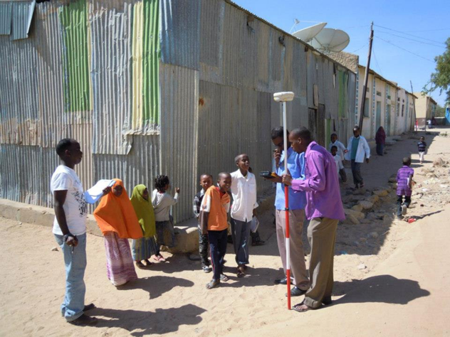
Field data collection with open source technologies
From May 19 to May 28 2020
A Geographic Information System (GIS) is a system designed to capture, store, manipulate, analyse and manage geographical data. The goal of both courses is to train participants to exploit the ever-increasing available satellite data with open source software as a useful tool in several development cooperation applications.
The 2nd course “Field data collection with open source technologies” is addressed to anyone who wants to acquire skills about modern and user-friendly procedures to plan and realise field data collection campaign, reducing time dedicated to data enter.
Only open source app (mostly for Android) and software will be used to ensure a full sustainability of future application of training contents and methodologies replication.
Neither specific prerequisites nor particular skills are required to enrol: you need just one computer with internet connection, be able to rename a file/folder and open files. All training goals will be achieved starting from zero. The module will include theoretical lessons and practical exercises. One Slack group will be activated during the course to facilitate interaction between the participants and the trainer.
Registration deadline: March 31
Field data collection with open source technologies
€
80 Sconto del 10 % per chi ha già frequentato o è iscritto ad altri corsi della Scuola COSPE
4 modules
6 hours
The course in detail
Modules
Module 1: Define data types for field data collection – 19/05/2020 18:00-19:30
Module 2: Field forms production – 21/05/2020 18:00-19:30
Module 3: Field data collection – 26/05/2020 18:00-19:30
Module 4: Data sharing – 28/05/2020 18:00-19:30
The course is available both as classroom lessons and online lessons through our webinar platform. Moreover, all lessons are recorded and available to registered participants for re-listening during your most convenient time.